TEA Beach Runoff Videos, September 18, 2004
(Click to see video and explanation)
|
|
|
|
|
MVI_9812.AVI |
MVI_9813.AVI |
MVI_9814.AVI |
|
|
|
|
|
MVI_9815.AVI |
MVI_9816.AVI |
MVI_9817.AVI |


TEA beach stormwater runoff photos – April 7, 2005
(Click photo to see enlargement)
 DSC_0072.JPG upper parking lot, west side of Truesdale Lake Drive between #21 and #23 |
 DSC_0073.JPG down the hill to the lower lot showing blacktop apron |
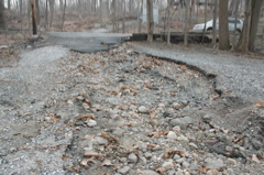
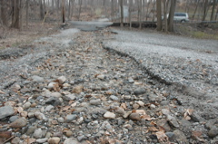
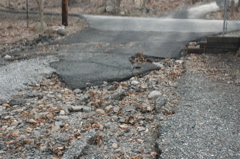
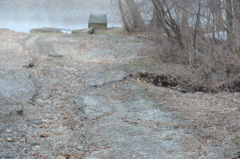
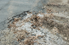
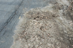
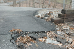 DSC_0074.JPG between upper and lower lots showing erosion |
 DSC_0075.JPG view east from mid-lower lot towards street |
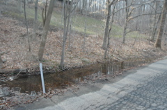
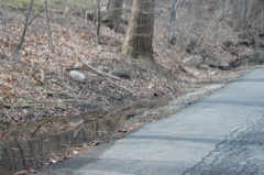
 DSC_0076.JPG erosion plus stream just north of the lot |
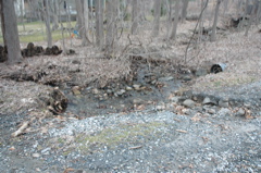 DSC_0077.JPG looking north to #23 Truesdale Lake Drive, stream encroaching on parking lot |
 DSC_0078.JPG looking west towards highway garage from Truesdale Lake Drive |
 DSC_0079.JPG view east from mid-lower lot towards street (from lower angle) |
 DSC_0080.JPG view east from mid-lower lot towards street #3 |
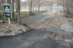
 DSC_0081.JPG close to lake edge, debris from runoff |
 DSC_0082.JPG on TEA dock, looking east; newest gravel and sand delta visible in foreground |
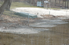 DSC_0083.JPG from TEA dock looking southeast towards TEA beach; delta/sediment visible |
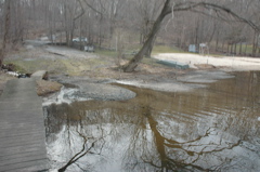 DSC_0084.JPG at end of TEA dock, wider shot |
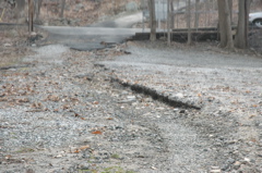
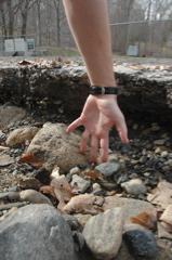 DSC_0085.JPG closeup of erosion on lower lot, tip of finger to watch band = 9 inches approx |
 DSC_0086.JPG view from beach gate looking southeast, secondary erosion in grass hill |
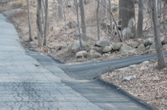
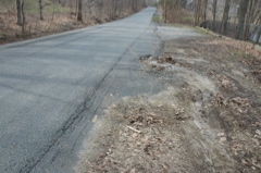
 DSC_0087.JPG looking northwest at lower lot to upper lot |
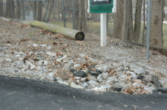
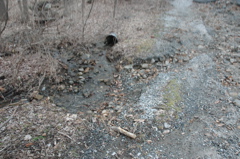
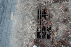
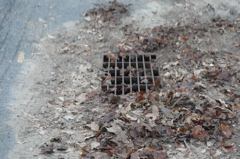
 DSC_0088.JPG catchbasin in north end of lot |
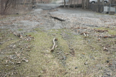
 DSC_0089.JPG view west from Truesdale Lake Drive |
 DSC_0090.JPG view west into lower lot |
 DSC_0091.JPG view west #2 |
 DSC_0092.JPG comromised catchbasin installed approx 18 months prior (check highway dept records for exact date) |
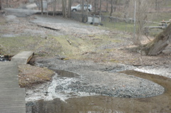
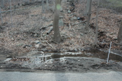
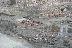
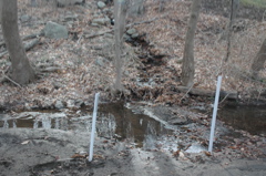 DSC_0093.JPG 7 days after storm still has standing water |
 DSC_0094.JPG 7 days after storm still has standing water #2 |
 DSC_0095.JPG |
 DSC_0096.JPG catchbasin on east side of Truesdale Lake Drive |
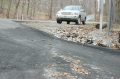
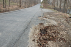
 DSC_0097.JPG view northeast from center of Truesdale Lake Drive to driveway of #20; note new road work |
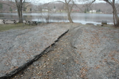
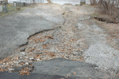
 DSC_0098.JPG detail: west side of TLD erosion onto upper lot of TEA beach |
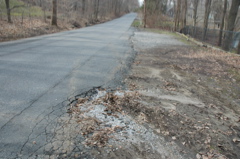 DSC_0099.JPG wider shot: west side of TLD erosion onto upper lot of TEA beach |
 DSC_0100.JPG detail: west side of TLD erosion onto upper lot of TEA beach #2 |
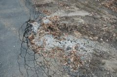
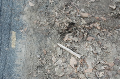
 DSC_0101.JPG wide shot #2: west side of TLD; note yellow paint on blacktop marking storm drain (clogged with vegetation and dirt) |
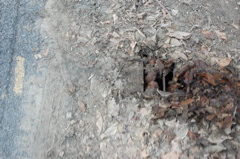
 DSC_0102.JPG closer view of obstructed stormdrain on west side of Truesdale Lake Drive |
 DSC_0103.JPG overhead view of obstructed stormdrain on west side of Truesdale Lake Drive |
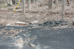
 DSC_0104.JPG #1: cleaning debris from storm drain |
 DSC_0105.JPG #2: cleaning debris from storm drain |
 DSC_0106.JPG #3: cleaned debris from storm drain |
 DSC_0107.JPG #4: cleaned debris from storm drain |
Pingback: Stormwater work underway on Truesdale Lake Drive « Truesdale Lake
Pingback: Truesdale Lake Drive Beach Project Recap « Truesdale Lake