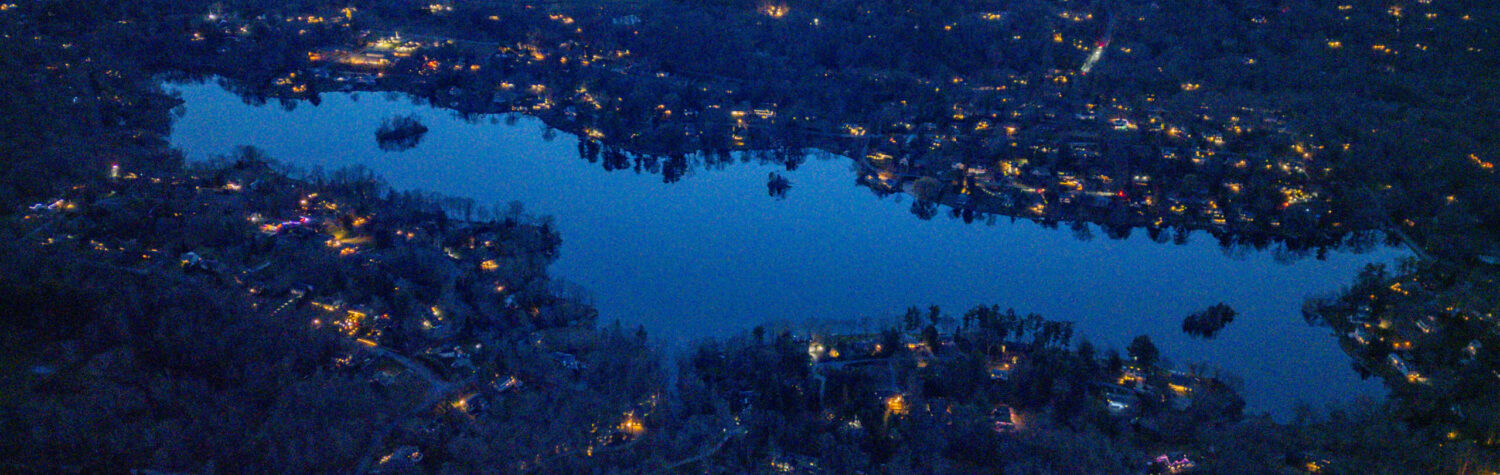
We look forward to seeing each of you at 5:45 PM on Friday December 19th for caroling at the Gilbert Street Beach!
Luminary Information for Caroling Event
Luminary Information & Instructions:
In the spirit of giving, this year we are raising funds to donate to Feeding Westchester for our luminary fundraiser. You can learn more about this wonderful organization by visiting here.
Light up the way for our carolers while helping our communities in need in this season of giving. Click here to order luminaries.
Luminaries will be delivered to your home the week of December 15th. Light them on December 19th, around 5 PM, in show of your support and to create a magical night for our community. Instructions will be emailed out once orders are received.
Luminary Orders are due by December 16th.
Thank you for your generosity and support! Much love, The TLPOA Social Committee
November 5, 2025
by rob Comments Off on Save the Dates – Adult BYOB Nov 14 & Caroling Dec 19!
Happy November, Neighbors! Before the weather gets too chilly, we have a few fun events to look forward to—and a big thank you to everyone who made October such a special month around the lake!
All associations are welcome!
Adults-Only BYOB Beach Night – Friday, November 14 | 6:30 PM | Gilbert Street Beach
Join us for a cozy evening under the stars! Bring your favorite beverage or appetizer to share, warm up by the fire, and enjoy some relaxed community time.
We’ll also be holding a fun raffle to help raise funds for future events—and we’re looking for raffle item donations! This can be a skill (a garden consult, a music lesson) or a special item (a bottle of wine, handmade art, etc.). If you’d like to contribute, please email Marissa!
We will also be selling Truesdale Lake Vinyl stickers!
And a big Thank you to those who donated raffle items for our October Adult BYOB – including The Lyness family who donated a $150 gift card to Luc’s Cafe! We raised over $300 for future social events!
Save the date for Caroling!! Friday, December 19th | 5:45 PM | Indian Lane Dam to Gilbert Street Beach
Come join us for what is without a doubt our most special event of the year!!
We will meet at the Indian Lane Dam at 5:45 and carol over to the Gilbert Street beach.Party to follow: hot cocoa, a warm fire & even a visit from our favorite man in red!
**Details on Luminary fundraiser to come!
*A heartfelt thank you to all who came out in October!*
If you have an idea for an event or gathering you’d love to see, don’t be shy! We’re always happy to support neighbors who want to bring something special to life around the lake and would love to help you execute it!
See you in November! The TLPOA Social Committee Marissa, Bree & Megan
October 29, 2025
by rob Comments Off on Stay Safe During Twilight Walks!
As the days get shorter and the evening light fades earlier, many of us are out walking or walking our dogs during twilight hours. This time of day can be especially tricky for visibility — for both walkers and drivers — and a few simple precautions can make a big difference in keeping everyone safe.
For Walkers & Dog Owners:
Wear reflective or light-colored clothing. A small reflective vest, armband, or clip-on light can make you much more visible to drivers.
Carry a flashlight or use a headlamp. It helps you see uneven pavement and lets drivers see you sooner.
Walk facing traffic. This gives you a clear view of oncoming cars and more time to react if needed.
Keep pets visible. Reflective leashes, collars, or light-up tags are easy additions that make a big difference.
For Drivers:
Slow down and stay alert, especially at dusk. Reduced light can make it hard to spot people and pets along the road.
Avoid distractions. Keep your eyes on the road — pedestrians can be hard to see even with headlights on.
Use high beams when appropriate. This helps illuminate road edges where people or animals might be walking.
Let’s all do our part to keep our community safe and enjoyable for everyone — whether on two legs or four.
Everyone use these same safety tips during Halloween! We hope everyone has a safe & fun Halloween!!
October 21, 2025
by rob Comments Off on Fall 2025 TEA Membership Meeting: Mon, Nov 10th
FALL 2025 Membership Meeting Monday, November 10th @ Horse & Hound
The TEA Annual Spring Membership Meeting is planned for Monday, November 10th at the Horse & Hound at 94 Spring Street. We also plan to have a laptop/camera at the meeting broadcasting over Zoom for TEA members interested in watching remotely.
Meeting will begin at 7:00 p.m.
Note: This meeting is for TEA Members only.
Email tea@truesdalelake.com to RSVP for in-person. If you want the Zoom Link please ask for it when you RSVP.
If you are new to the TEA or you want to update us on your information, please fill out the TEA Resident Questionnaire. Thanks!
Agenda ➡ President and other Officer reports ➡ Treasurer:
YTD FY2025-2026 Budget vs. Actual review
Our Fiscal Year is April 1 – March 31
➡ Beach Report / Lake Committee update
➡ Projects Update: Drawdown / Septics / Sewer / Dock / Shed ➡ Upcoming meeting schedule for coming year.
Zelle – members payment – direct electronic payment went live in 2024 and worked well the past two years. If you have not yet paid for 2025 please Send your dues payment in immediately either via mail or Zelle – Payment is to tea@truesdalelake.com via Zelle. If you want to confirm receipt, email us at tea@truesdalelake.com and let us know you are sending a payment.
End of Summer Party September 2025 and pre-Full Moon Regatta
The TEA Officer roles are two year terms. We have new officers for the current 2 year (2025-2026) term.
Board members cannot be in the same role for two consecutive terms so if you want to take over a role after 2026 let us know.
WE ARE ALWAYS LOOKING FOR NEW BOARD MEMBERS! a lot of the same people have taken on the board and officer roles, some for many years. Fresh eyes and fresh energy is needed and valued. If you are new to the community and want to help, there are lots of ways to pitch in.
Current TEA Officers for 2025-26 (through end of 2026):
President (Rob Cummings) – organizes & runs meetings, in charge of recruiting next president and officers. Can sign checks.
Vice President (Jo Ann Ferrigno) – runs meetings when President can’t attend. Fills in other roles as needed. Can sign checks.
Treasurer (Ellen Rose) – deposits checks, writes checks, tracks and reports on income/expense and bank balances. Tax filing 990.
Recording Secretary (Howard Citron) – Takes meeting minutes, sends drafts to board and membership attendees post-meeting.
Corresponding Secretary (Debbie Fink) – Receives and replies to association correspondence.
Sergeant-at-Arms (Mike Gorman) – guards the door (or virtual door).
Formal roles for Officers are in the TEA Bylaws here:
At-large Board members (7-10 members needed) attend 4 standing meetings per year. Current board members are: Mike Vellensky, Lisa Capobianco, Glenn Capobianco, Sarah Polizzotto, Kate Grieve, Harron Appleman, Melissa Scarlatto, Tom Houlihan, Ira Sanchick, Kathleen Ward Gallagher, Carol Gamez, and Wendy Daniels.
Sarah Polizzotto and Kate Grieve are beach co-chairs. Thank you Kate and Sarah!
Standing Association Meetings are on the following schedule (Add to your Calendars!): -TEA Membership Meetings (entire membership invited 2x/year): —SECOND Monday of April (April 13, 2026, NEXT MEETING Spring Membership Meeting) —SECOND Monday of November (Nov 10, 2025, Fall Membership Meeting, the one coming up) -TEA Board Meetings (board members only): —SECOND Monday of March (March 9, 2026) —SECOND Monday of October (Oct 12, 2026) Special Meetings can be called for association business.
Critical positions that don’t have to be board members:
Beach Chairperson – coordinate beach clean-up, monitor beach conditions, keep an eye on beach things like electricity and trash service. Lots more! A lot of overlap with the Social Chairperson.
Social Chairperson – Plan and get volunteers for any social events – primarily the Summer Kickoff BBQ the second weekend in June. Some events can be at our beach while others we can coordinate with TLPOA. This position is all about fun!
Volunteer Opportunities & Committees:
Beach Clean-up Day – the Saturday before Memorial Day Weekend (May) each year. Lots of sand spreading, weed cleanup, general maintenance, and straightening up the beach getting ready for the first official weekend of summer on Memorial Day Weekend.
Floats and Dock installation, management, and winterizing – 2-3 people needed – at the beginning of the season, usually on Beach Clean-up Day, volunteers put out the floats and swim dock. 2-3 people. At the end of the season, this group pulls in the floats and winterizes & secures the swim dock
Lake Management Committee Member – be the TEA liaison to TLPOA Lake Manager John Gusmano and Pond & Lake Connection (James Gorman, main contact). Participate in email communications and bring any concerns to the TEA & TEA Board. More info: http://truesdalelake.com/lake-management/
CSLAP Testing Member (1 person needed) – We are looking to rejoin the New York State Federation of Lake Associations “Citizens Statewide Lake Assessment Program” which uses trained volunteers to sample the water conditions of Truesdale Lake and hundreds of other NY State Lakes. More info is at: https://www.dec.ny.gov/chemical/81576.html
Resident Canada Geese Registration and Egg Control program volunteers (2-3 people needed to go out to the islands in March and April) – Each year we get permits from the United States Fish & Wildlife Service (FWS) to oil and addle eggs in the nests of Resident Canada geese. 20+ years ago there were hundreds of Canada geese that would take up permanent residence on Truesdale Lake for the summer. This causes unhealthy conditions in the lake and on lawns. More information at truesdalelake.com/goose
Truesdale Lake Dock Committee (TLDC) – We have a joint TEA/TLPOA/Vreeland/Lake Shore Drive committee that accepts applications for new and renovated docks. The TLDC process is designed to help the homeowner comply with our requirements and the Town of Lewisboro’s regulations..
Ad-hoc Building Committee – We built two boat racks at the TEA beach. These racks have 2 spots available for TEA members. If you are interested in a spot on the rack, the season rental is $100. If you are interested in helping build an additional boat rack at our TEA Gilbert/Lake Shore boat launch property let us know. Other projects of the Building Committee in 2025 will include the new shed installation including a proposed tiki bar(!?)
Landscaping committee – anyone with ideas to beautify our already lovely beach let us know. We have ornamental grasses along the boat launch fence side. Always looking for additional ideas to make it look good.
Projects for the following items at the beach:
Boat Launch Dock, bridge, and path
Storage Shed / electric
Landscaping on street side of beach fence.
Anything else you can think of? Let us know…
Some helpful links for lake residents new and old:
For residents new to the lake, download the TEA Welcome and Information Packet from this link above as well.
*If you are interested in volunteering for the TEA board or a specific activity, please email tea@truesdalelake.com or fill out this questionnaire.
Contact Information
Truesdale Estates Association PO Box 363 South Salem, NY 10590 tea@truesdalelake.com
*if you are not current with your TEA dues, you cannot vote until your dues are brought current.
TEA Board Meeting – Notes FALL 2025 – SUMMARY OF ITEMS OF INTEREST
Drawdown 2025-26
Successful drawdown this past winter 2024-25 – this was significant because winter before (2023-24) the drawdown was not successful (due to equipment failures and unusually warm winters causing water to flow all winter long).
No drawdown in 2025-26.
Lake management best practices advise staggering years for drawdowns so the flora does not become adjusted to it.
Halloween Parade – 2025 - Reminder! THIS upcoming Saturday, October 25th – 10:30 AM
*All Truesdale Lake residents welcome*
Parade Details: Don your spookiest, most creative Halloween Costumes and meet us behind the Lewisboro Library at 10:30 AM! Decorate wagons, strollers, etc and join us as we parade to the Gilbert Street beach together! Go all out! Music & spooky songs will lead the way!
**If you aren’t walking in the parade we highly encourage you to cheer on your neighbors along the route of Lake Shore Drive.
Beach Party to Follow: Once we get down to the beach we will be voting on the pumpkin carving contest, enjoying refreshments, and playing some fun, seasonal games!
Even if you do not join the parade you’re welcome to join us at the beach.
Pumpkin Carving Contest: We will be having our annual pumpkin carving contest. Voting will happen at the beach. If you are interested in participating please email Marissa.
Bring the pumpkins down to the beach the morning of the parade between 9am and 10am. The winner will be granted a prize!
A thank you to our local library
Every year the Lewisboro Library generously allows us to use their library as a starting point for our parade. We are so grateful for their continued support. Here are some Halloween-themed activities that they are offering this year: South Salem Ghost Walk – October 24 at 7 pmhttps://lewisborolibrary.org/event/south-salem-ghost-walk-3/
See you all there and HAPPY HALLOWEEN!!
October 2, 2025
by rob Comments Off on Two CSLAP Volunteers Needed
We need two new volunteers to collect and process water samples once a month (June, July, August & September). This will continue the work Susan and Dieter have done over the past few years. The volunteers will be trained and all required equipment provided with the exception of a boat to get out on the lake.
More info:
The Citizens Statewide Lake Assessment Program (CSLAP) is a volunteer lake monitoring program run by the NYS Department of Environmental Conservation (NYSDEC) and the NYS Federation of Lake Associations, Inc. (NYSFOLA). The analysis of our lake data provides real information on the health of our lake. Here is a link which provides more information on the program and sampling process. https://nysfola.org/what-is-cslap/
Any questions can be directed back to me, thanks – John (use Contact Us to get in touch and we will pass on your note to John)
October 1, 2025
by rob Comments Off on October 2025 Social Events
THIS Friday, October 3 | 6:30 PM | Gilbert Street Beach
Join us for a cozy evening under the stars! Bring your favorite beverage or appetizer to share, warm up by the fire, and enjoy some relaxed community time.
We’ll also be holding a fun raffle to help raise funds for future events—and we’re looking for raffle item donations! This can be a skill (a garden consult, a music lesson) or a special item (a bottle of wine, handmade art, etc.). If you’d like to contribute, please email Marissa! (RSVP)
Fall Garden Club Meet Up
Saturday, October 11 | 10 AM | Gilbert Street Entrance
Join fellow garden lovers as we plant bulbs and perennials to bring next year’s blooms to life!
**Have something to share? We’re happily accepting donated perennials to add to our lakefront spaces. Let’s dig in and grow something beautiful—together!
Halloween Parade & Party
Saturday, October 25 | 10:30 AM | Gilbert Street Beach
Meet behind Lewisboro Library in costume and parade to the beach!
Decorated strollers, wagons, and costumes encouraged! Party to follow: cocoa, donuts, games, pumpkin carving contest!
** Drop off your carved pumpkins before the parade to enter.
** Not marching in parade? Encouraging all on parade route to cheer everyone on with cowbells, music, pots and pans!
September 16, 2025
by rob Comments Off on Upcoming Fall 2025 TLPOA Social Events
We hope you had a joyful, safe, and sunny summer! As we ease into fall we want to continue our efforts to build community throughout the lake inviting everyone, regardless of association, to join on any of these events.
Friends & family are of course always welcomed at our social events (encouraged, even!), with a small donation being requested for each non-resident family joining.
Here’s what’s coming up:
Truesdale Lake Triathlon & Duathlon SATURDAY, Sept. 20th | 8:00 AM | Gilbert Street Beach
A low-key, just-for-fun race—open to all levels!
Triathlon: ~750 yd swim • 9 mi bike • 2.6 mi run Duathlon: 9 mi bike • 2.6 mi run (no swim!) Prizes for top finishers and best costumes $30 entry fee includes t-shirt, drinks, and fun surprises. Not racing? Cheer from your driveway with pots, pans, instruments or cowbells!
Immediately following the Triathlon, join neighbors to support the Lewisboro Library!
Enjoy a car show, kids’ zone, food trucks, music, shopping, a beer & wine garden, and more.
Adults-Only BYOB Beach Night Thursday, October 3 | 6:30 PM | Gilbert Street Beach
Bring a drink or snack to share, cozy up by the fire, and enjoy a fun evening under the stars.
RSVP to Marissa
Halloween Parade & Party Friday, October 25 | 10:30 AM | Gilbert Street Beac
Meet behind Lewisboro Library in costume and parade to the beach!
Decorated strollers, wagons, and costumes encouraged! Party to follow: cocoa, donuts, games, pumpkin carving contest! ** Drop off your carved pumpkins before the parade to enter.
** Not marching in parade? Encouraging all on parade route to cheer everyone on with cowbells, music, pots and pans!
Excited to see you all out there this season!
The TLPOA Social Committee
Marissa, Bree & Megan
August 2, 2025
by rob Comments Off on ### UPDATE! SEPT 7th – same time & place ### Sunset Send-Off: End of Summer Bash
You can row, paddle, or sail your craft over to the TEA Beach starting around 4pm. Landing at the boat launch or beach is fine. Prepare your moonlight regatta lighting ahead of time on your boats so you can enjoy the festivities on land before pushing off.
Note: if you don’t have a Truesdale Lake stickered boat, please do not bring your own boat. We will figure out suitable craft for you to ride along in or take out – but PLEASE let us know at least a day in advance (tea@truesdalelake.com) so we can find space or boat for you ahead of time if needed. Day of event boat space will be very limited if at all.
It will be getting dark around 7:45pm so we will head out to the center of the lake before then (7:30) to join others who are coming out.
At the BBQ, TEA will supply:
the music
the charcoal
the protein – burgers, dogs, and chicken (plus buns and condiments)
soft drinks (soda, water, seltzer, iced tea) plus cups & ice for drinks
the plates & bowls & utensils & napkins
The rest is up to attendees. Bring your choice of sides, desserts, chips, snacks, hard drinks, hot drinks, etc. Your specialty or something you pick up at the store – it’s up to you!
Make sure you bring lights to help you get back to your dock or boat launch area!
NOTE – the event is weather-dependent! If the weather is questionable, we will post updates on this website and on our instagram (instagram.com/laketruesdale) leading up to the event!
July 30, 2025
by rob Comments Off on Lake Algae Treatment Tomorrow 7/31/25