These are some of the email reports and communications from Scot Evans from Truesdale Lake, James Gorman from Pond & Lake Connection, and others involved with the project. Putting selected parts up here for all to see what some of the discussion and learning is looking like.
October 29, 2019
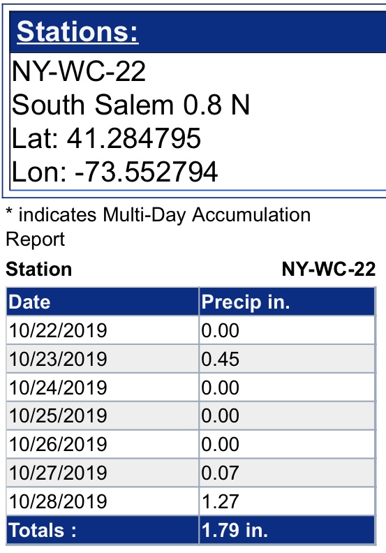
Summary: Sunday 10/27/19 brought us the remnants of Tropical Storm OLGA, where we received 1.34 inches of rain in the twelve hours between 4 am and 4 pm.
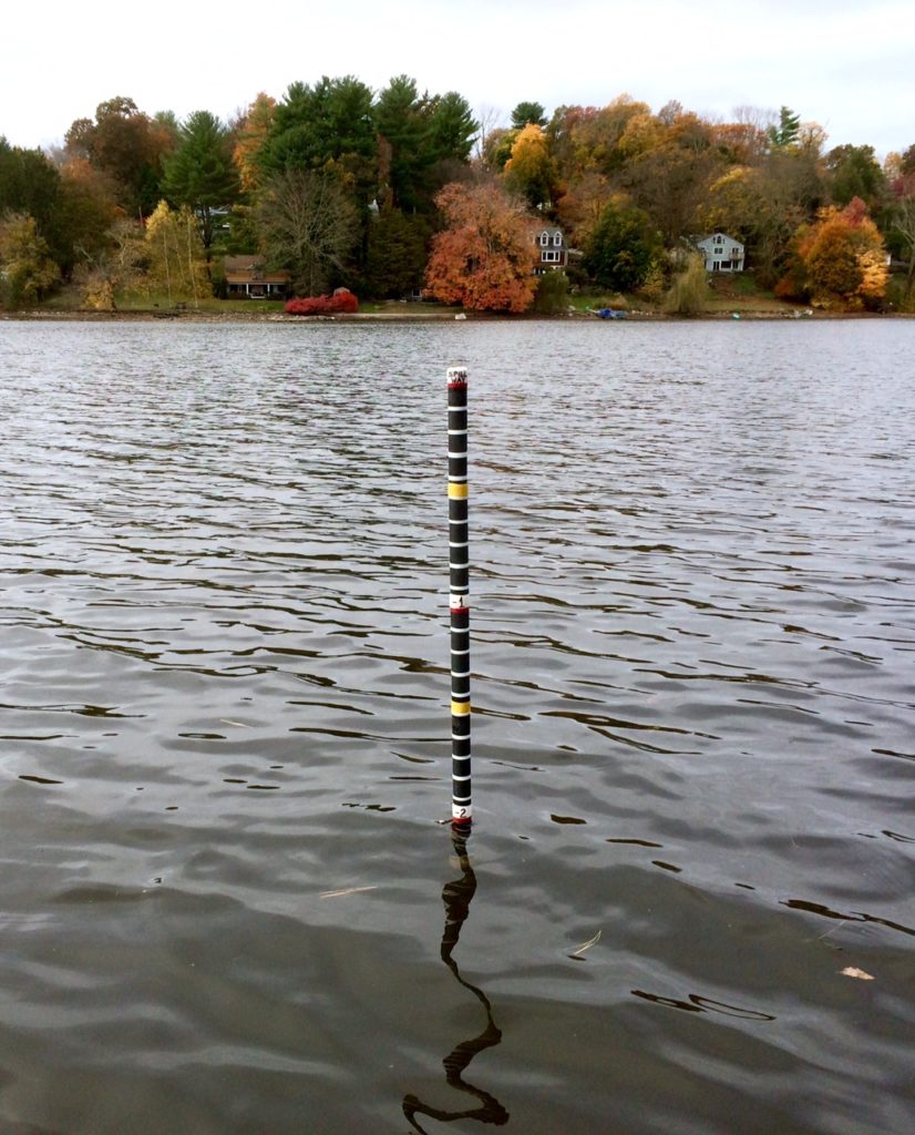
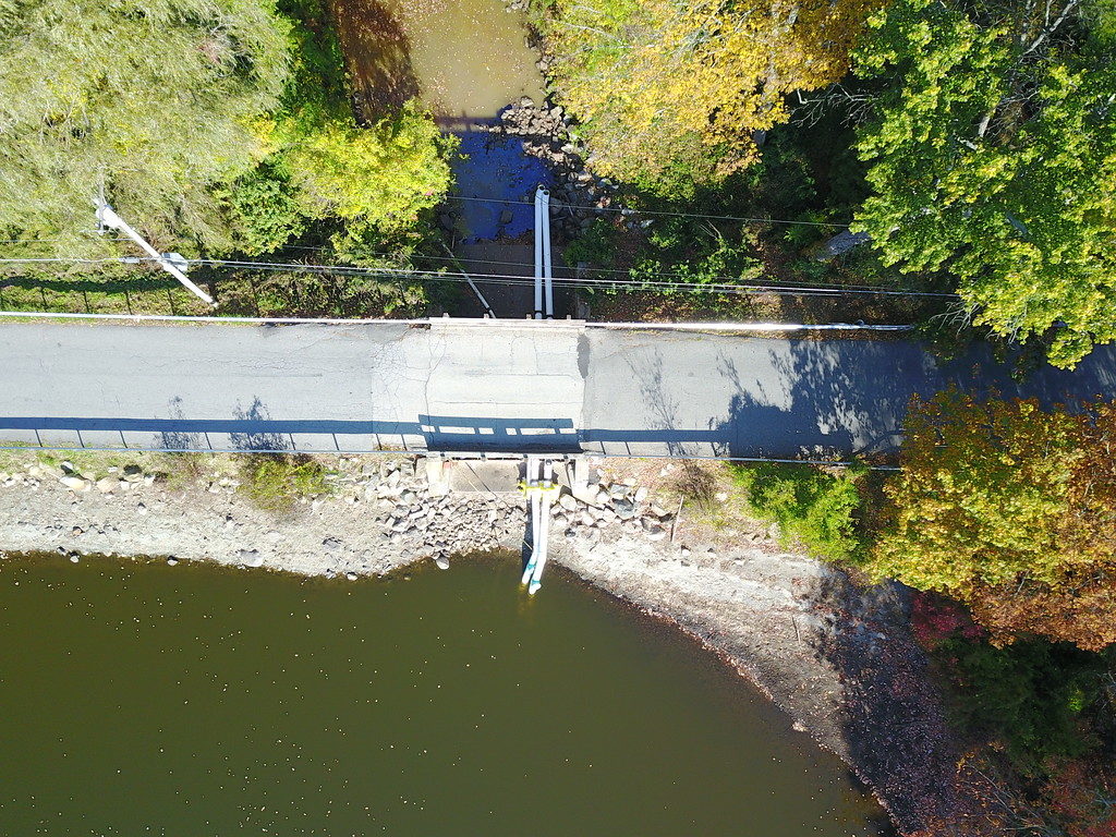
During the 24 hours after the storm ended, the lake level rose 5″ even with all three siphons discharging a total of 1,100 CFM. Monday 10/28/19, the west 12″ siphon was observed to have stopped flowing; James Gorman was notified.
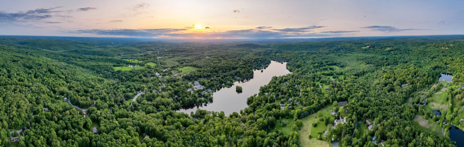
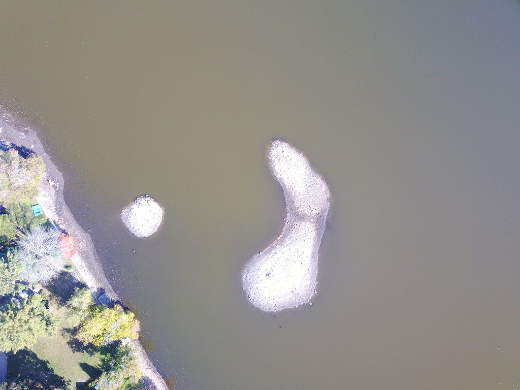
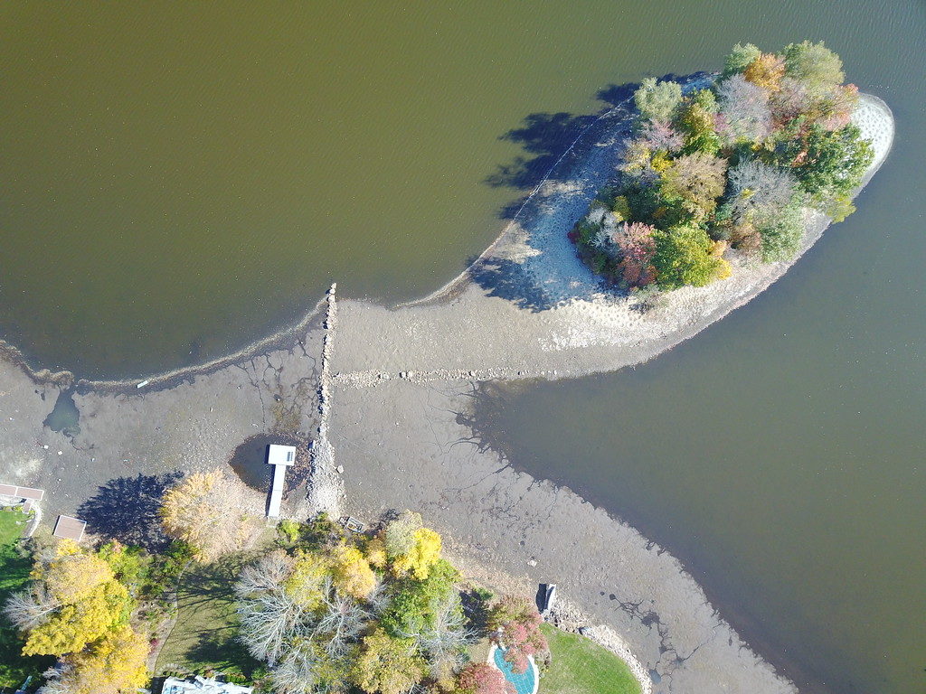
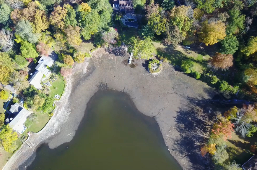
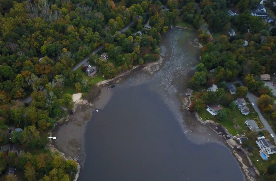
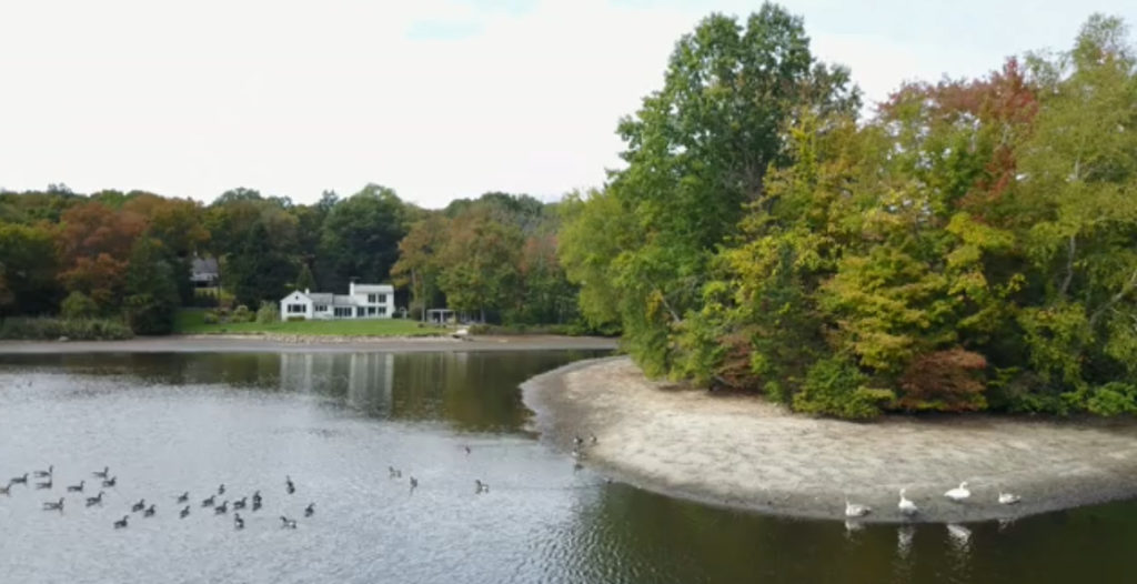
Mark Vibert of Main St recommended on the NextDoor site that we try to obtain aerial photos of the exposed lakebed during the drawdown target depth of three feet below the spillway deck. Rob Cummings responded and on Tuesday 10/15/19, he brought a borrowed drone over to my place, where we got some impressive aerial shots and video from several altitudes over the lake.
Ideal weather was enjoyed by the drone on this day before the bomb cyclone nor’easter dumped 3.34″ of rain and the lake level rose 17 inches over the next 3 days. Rob remarked that this demonstrates we’ll have no problem quickly refilling the lake this spring.
Daily Observations:
TUE 10/22/19 LG -2.0 feet Harold Ossher observes 6″ siphon not flowing (cause unknown) and one 12″ siphon still flowing at 500 CFM
WED 10/23/19 LG -2.0 feet 0.45″ rainfall received from weak coastal low
THU 10/24/19 LG -2.0 feet one 12″ siphon matching the inflow rate
FRI 10/25/19 LG -2.1 feet James restarts two more siphons and all three are flowing by 0845 EDT at 1,100 CFM
SAT 10/26/19 LG -2.3 feet Siphon discharge exceeds inflow
SUN 10/27/19 LG -2.4 feet TS OLGA delivers 1.34″ rain and inflow exceeds siphon discharge
MON 10/28/19 LG -2.0 feet LLR 4.8 inches as inflow continued to exceed siphon discharge. Equilibrium achieved about 1700 EDT. West 12″ siphon stopped flowing (cause unknown).
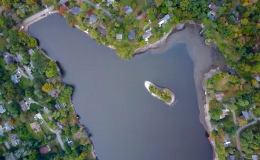
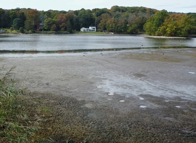
Aerial shots of exposed lakebed::
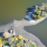
The three islands named on the interactive map are WAXWING (north), ANT (center) and PIRATE (south).
A new set of islands became visible during the drawdown. I propose that this set be named BOAT PRANG ARCHIPELAGO or LARA’S GALAPAGOS.
Here are a few aerial photos of the lake from the many taken. I’ll post more this week on a NextDoor thread.

Thanks Scot for this update
Really interesting to watch how this all unfolds
Thanks again
David
Yes, thank you, and to you and Rob for the really interesting photos.
I’m not surprised the lake level rose after significant rain despite the siphons. The watershed is so big that there’s no way they can keep pace during periods of peak inflow. But once all of them are running again, the level should go down fairly quickly again.
– Harold
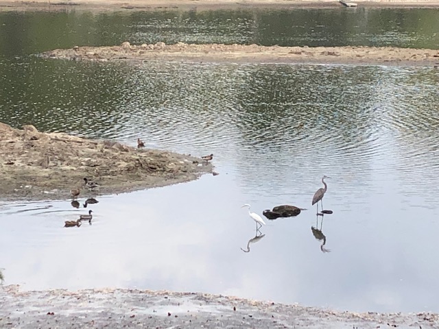
Love the photos! The “Galapagos†is an inspiring bird sanctuary attracting all manner of feathered friends – picture attached.
-Lara