

 Sunfish Fleet #27
Click on the images below to bring up larger scans.
This document is also available as a pdf download (26Mb)
Truesdale Lake: Key Stormwater Runoff Sites – Engineering Plans to Address Remediation
 Main Topographic Map depicting site locations around the lake.................................. 2
 Site #1, Lake Shore Drive, south end near intersection with Truesdale Lake Drive............... 3
 Site #2, intersection of Lake Shore Drive and Truesdale Lake Drive............................. 4
 Site #3, on Truesdale Lake Drive, beach area................................................... 5
 Site #4, off Boway, main stream feeding Truesdale Lake from east and Ridgefield, CT............ 6
 Site #5, northeast end of Truesdale Lake, north end of Hoyt St (lower extension)............... 7
 Site #6, intersection of Lake Shore Drive, Gilbert, and Bouton Street (west side of lake)...... 8
 Other details for site #3 (and other sites).................................................... 9
 Site #3 Check Dam Detail...................................................................... 10
 Riprap Detail................................................................................. 11
 Type "C-L" Catch Basin Double Grate Type II Detail............................................ 12
 Catch Basin Detail............................................................................ 13
 Vortechnics Stormwater Treatment System Detail................................................ 14
 Pavement Other Details........................................................................ 15
 Construction Notes............................................................................ 16
Plans by Land-Tech. Imaging by Rob Cummings.
For original plans, see David Sachs or Rob Cummings. Larger format scans are also available at www.truesdalelake.com website. Search for "Key Stormwater Runoff Sites" or look for link in the Lake Restoration Project home page.
Click on the images below to bring up larger scans.

Main Topographic Map depicting site locations around the lake

Site #1, Lake Shore Drive, south end near intersection with Truesdale Lake Drive

Site #2, intersection of Lake Shore Drive and Truesdale Lake Drive

Site #3, on Truesdale Lake Drive, beach area

Site #4, off Boway, main stream feeding Truesdale Lake from east and Ridgefield, CT

Site #5, northeast end of Truesdale Lake, north end of Hoyt St (lower extension)
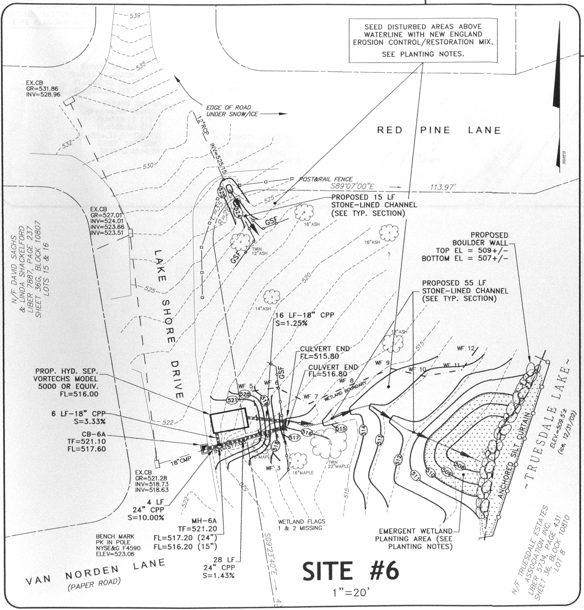
Site #6, intersection of Lake Shore Drive, Gilbert, and Bouton Street (west side of lake)

Other details for site #3 (and other sites)

Site #3 Check Dam Detail
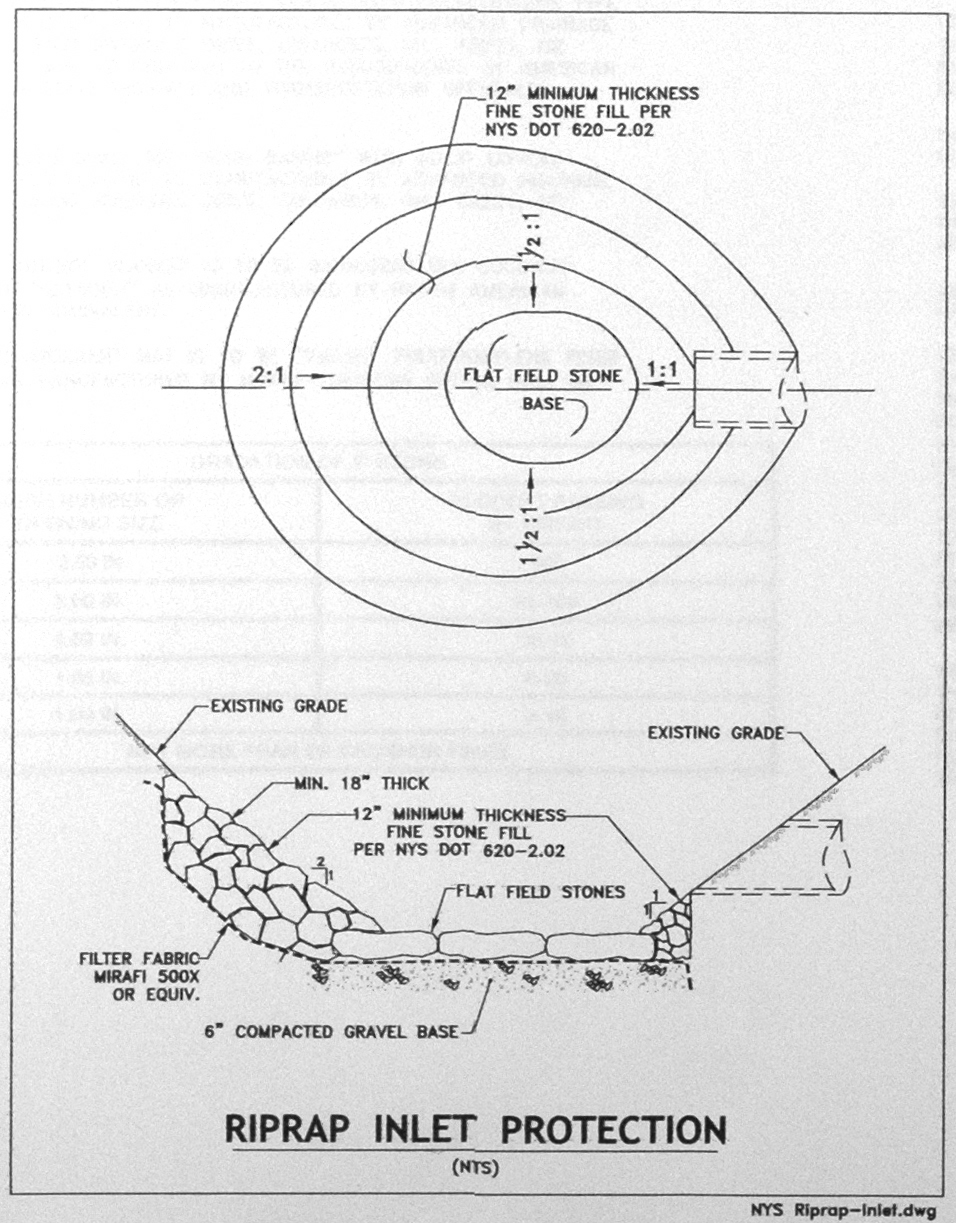
Riprap Detail
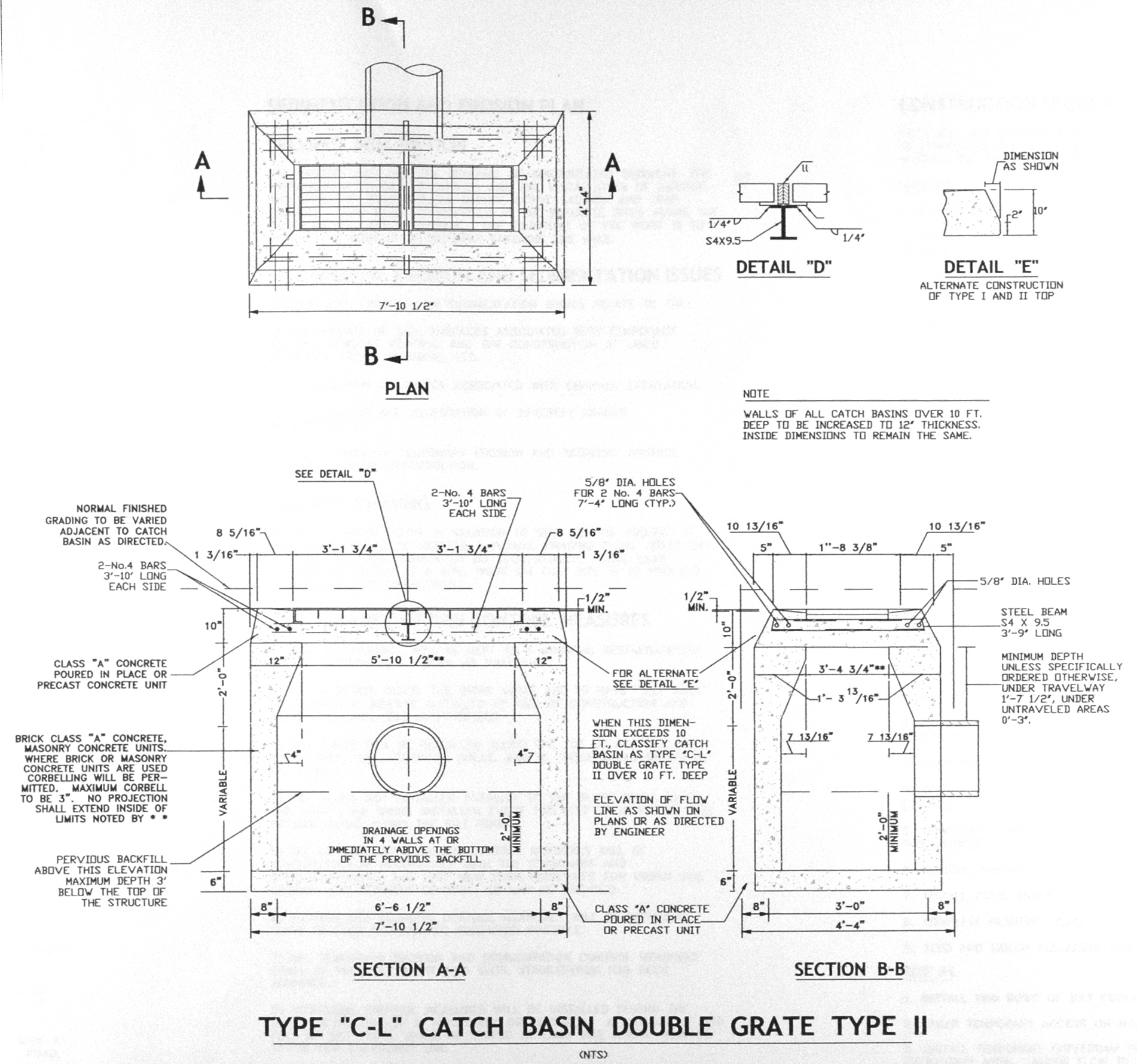
Type "C-L" Catch Basin Double Grate Type II Detail

Catch Basin Detail

Vortechnics Stormwater Treatment System Detail

Pavement Other Details
Construction Notes


The comments are owned by the poster. We aren't responsible for their content.

 10:00 - 14:00