This is a scan of the Watershed Map executed by Land-Tech for their lake study analysis in 2001. The black line represents the watershed area (approximately 2000 acres). The main aquifer for the lake is the Pumping Station Swamp and Wetlands in Ridgefield, CT. The main feeder stream flows under a bridge on Boway Rd on the east side of the lake
More information and the complete lake study document can be found elsewhere on this site.


 Sunfish Fleet #27


 ) Date (
 Scientific
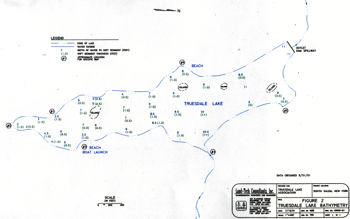 Truesdale Lake Bathymetry Map
 493
 976.56 KB
 All

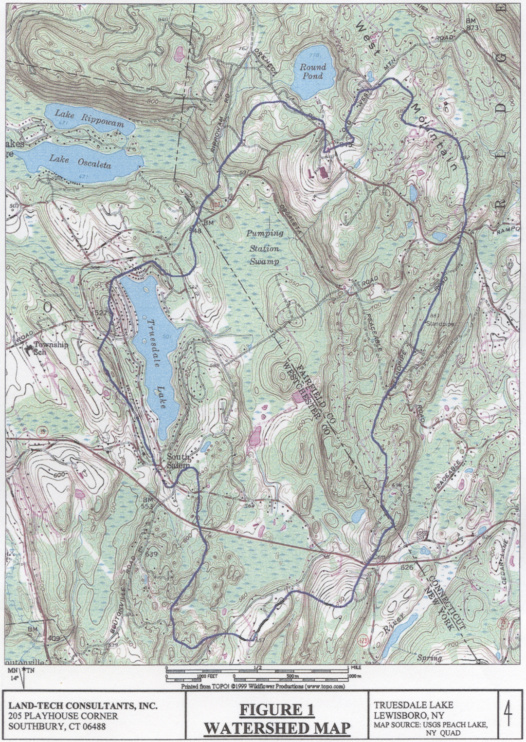 Truesdale Lake Watershed Map


 10:00 - 14:00