logo
Home  •  News  •  Forum  •  Login  •  Search  •  Register
 Highlights
 Boating
Sunfish Fleet #27
Boat Sticker Information
 Main Menu
 Login
Username:

Password:


Lost Password?

Register now!


Main : Maps : Scientific : 


Sort by:  Title () Date () Rating () Popularity ()
Files currently sorted by: Title (A to Z)

Category: Maps Scientific
Download Now!
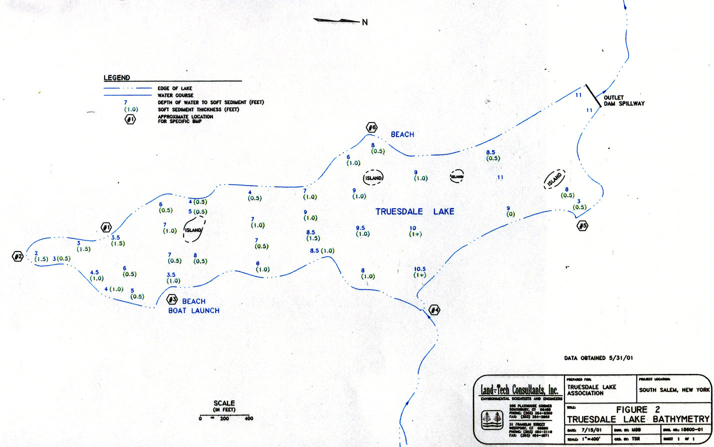
Truesdale Lake Bathymetry Map Popular Version: 1.0
Submitted Date:  2004/11/29
Description:
Bathymetry: \Ba*thym"e*try\, n. [Gr. ba`qos depth + -metry.] The art or science of sounding, or measuring depths in the sea. (Definition source: Webster's Revised Unabridged Dictionary, © 1996, 1998 MICRA, Inc.)

Measurements performed by Land-Tech in May 2001 for Lake Management Study.

Downloaded 492 times  492  File Size 976.56 KB  Supported Platforms All  Home Page http://
Rating: 0.00 (0 votes)
Rate this File | Modify | Report Broken File | Tell a Friend | Comments (0)


Category: Maps Scientific
Download Now!
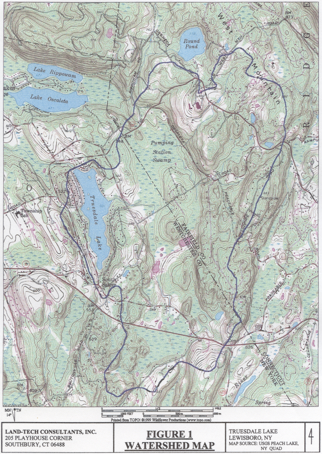
Truesdale Lake Watershed Map Popular Version: 1.0
Submitted Date:  2004/11/29
Description:
This is a scan of the Watershed Map executed by Land-Tech for their lake study analysis in 2001. The black line represents the watershed area (approximately 2000 acres). The main aquifer for the lake is the Pumping Station Swamp and Wetlands in Ridgefield, CT. The main feeder stream flows under a bridge on Boway Rd on the east side of the lake

More information and the complete lake study document can be found elsewhere on this site.

Downloaded 813 times  813  File Size 1.81 MB  Supported Platforms All  Home Page http://
Rating: 0.00 (0 votes)
Rate this File | Modify | Report Broken File | Tell a Friend | Comments (0)


 Search

Advanced Search
 Calendar
Last MonthOct 2009Next Month
Su Mo Tu We Th Fr Sa
1 2 3
4 5 6 7 8 9 10
11 12 13 14 15 16 17
18 19 20 21 22 23 24
25 26 27 28 29 30 31
Today
 Coming Events
  10:00 - 14:00
Silent Auction of Boats
Powered by XOOPS 2.0 © 2001-2004 Truesdalelake.com