Home
•
News
•
Forum
•
Login
•
Search
•
Register
South Salem Weather Forecast, NY
Highlights
Lake Tax District
TEA Home Page
TLPOA Home Page
Lewisboro Lakes
Don't Feed The Geese!
TEA Beach Runoff
Real Estate
Boating
Sunfish Fleet #27
Boat Sticker Information
Main Menu
Home
News
Contact Us
Downloads
Submit
Popular
Top Rated
Web Links
Forum
Sections
FAQ
Partners
Polls
piCal
Login
Username:
Password:
Lost Password?
Register now!
Main
:
Maps
:
Scientific
:
Category: Maps
Scientific
Truesdale Lake Bathymetry Map
Version:
1.0
Submitted Date:
2004/11/29
Description:
Bathymetry
: \Ba*thym"e*try\, n. [Gr. ba`qos depth + -metry.] The art or science of sounding, or measuring depths in the sea.
(Definition source: Webster's Revised Unabridged Dictionary, © 1996, 1998 MICRA, Inc.)
Measurements performed by
Land-Tech
in May 2001 for Lake Management Study.
493
976.56 KB
All
http://
Rating:
0.00 (0 votes)
Rate this File
|
Modify
|
Report Broken File
|
Tell a Friend
|
Comments (0)
Flat
Threaded
Nested
Oldest First
Newest First
The comments are owned by the poster. We aren't responsible for their content.
Search
Advanced Search
Calendar
Oct 2009
Su
Mo
Tu
We
Th
Fr
Sa
1
2
3
4
5
6
7
8
9
10
11
12
13
14
15
16
17
18
19
20
21
22
23
24
25
26
27
28
29
30
31
Today
Coming Events
10:00 - 14:00
Silent Auction of Boats
Powered by
XOOPS 2.0
© 2001-2004
Truesdalelake.com


 Sunfish Fleet #27
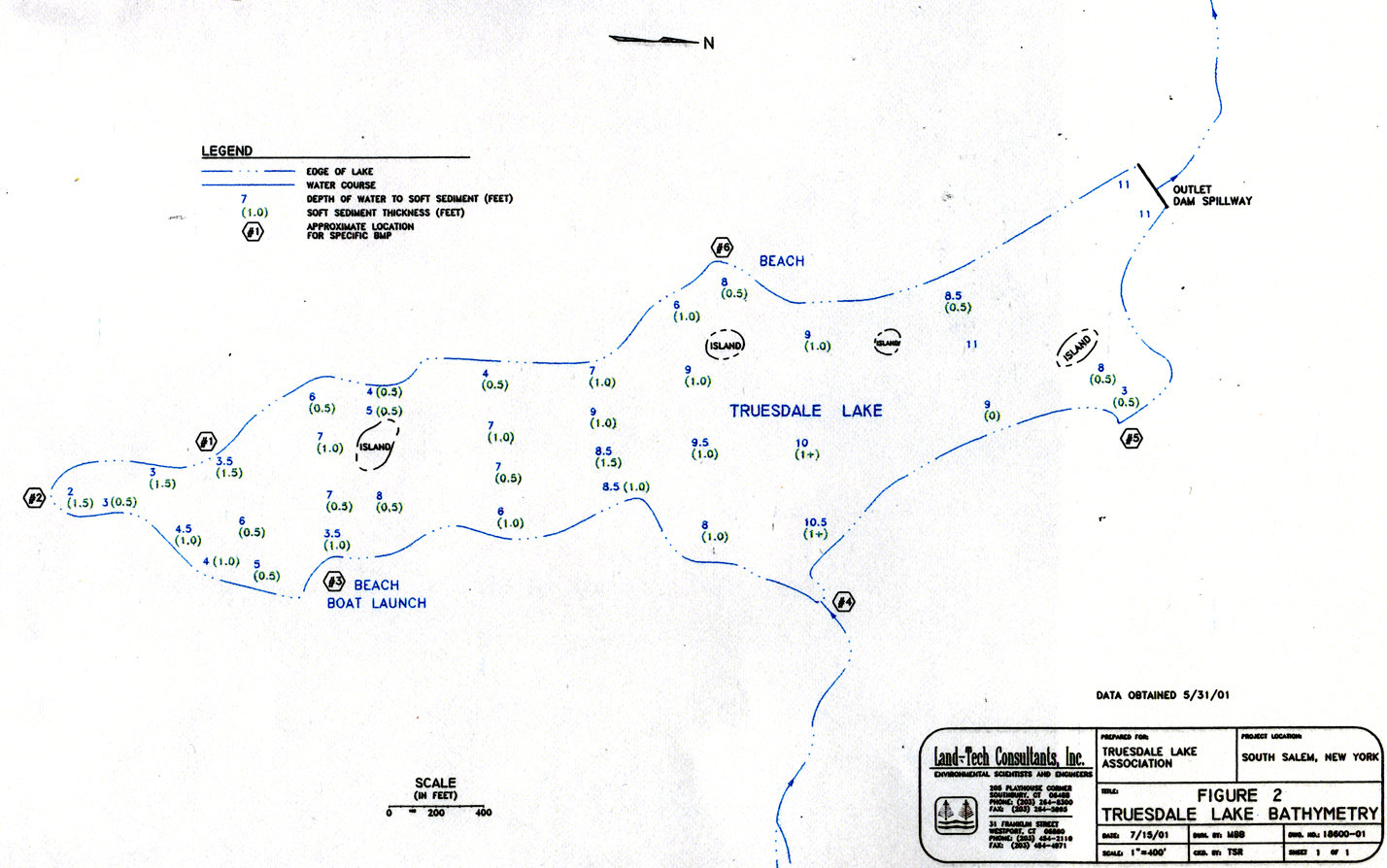 Truesdale Lake Bathymetry Map
  493
493  976.56 KB
  All
All 

 10:00 - 14:00